irroFlow.com.au - Coming soon
Spatial insight for water planning
Info
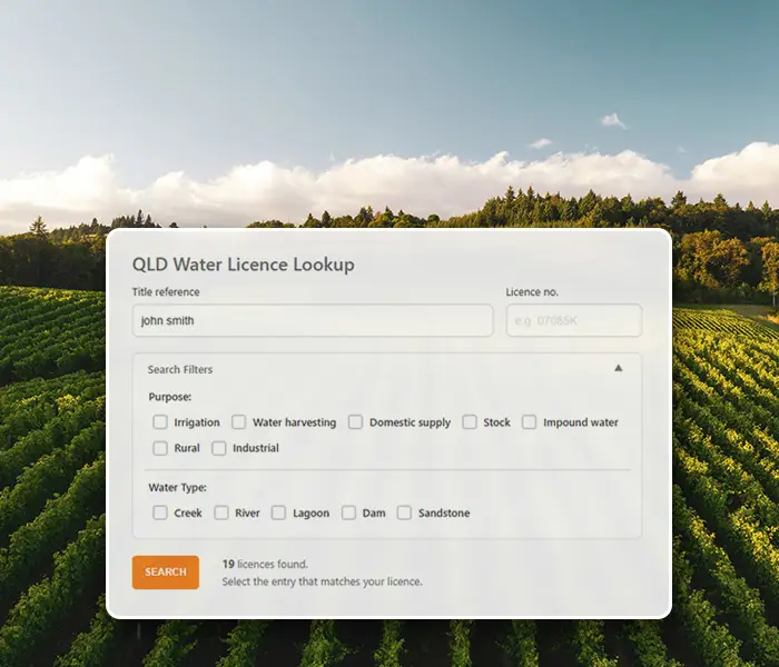
IrroFlow is an online water discovery and management platform designed to help landholders, planners and consultants better understand how water behaves across land.
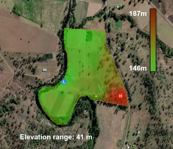
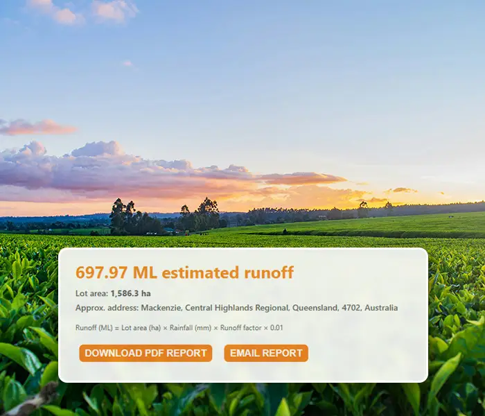
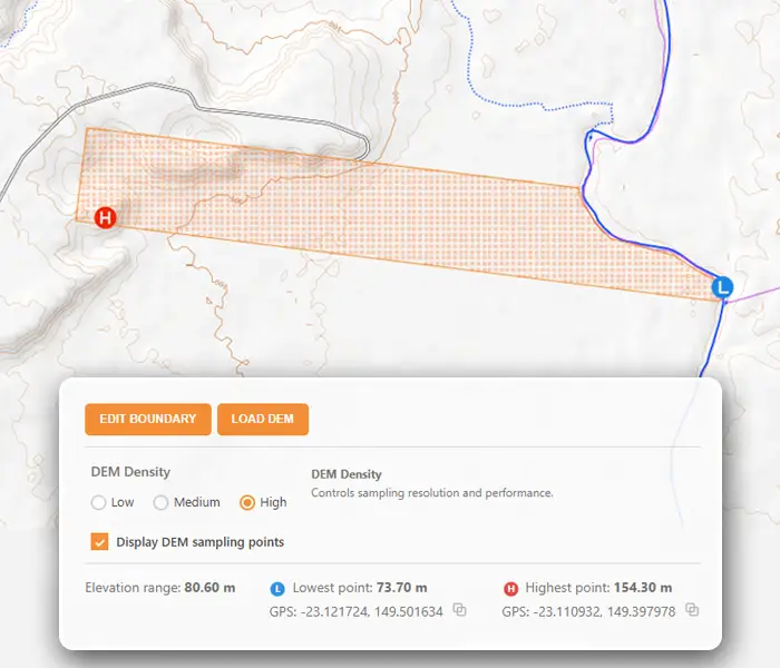
The platform brings together official spatial data, rainfall information and terrain analysis into one simple, interactive experience. Users can search sites by lot, plan or location, explore land elevation and terrain variation, define and edit catchment areas, and estimate rainfall runoff for properties, farms and paddocks.
IrroFlow supports early-stage dam and water storage planning, basic water flow analysis, soil and topography insights, and location-based historical and forecast rainfall data. All outputs can be reviewed visually on the map and summarised into clear, shareable reports.
Built for practical decision-making, IrroFlow helps turn land and water data into usable insight — from catchment discovery to everyday water planning.